Summary:
- Hurricane storms leave behind waste and vegetation that obstruct roadways across the island
- We propose implementing temporary debris management sites (TDMS) and optimizing their most beneficial location through data analysis
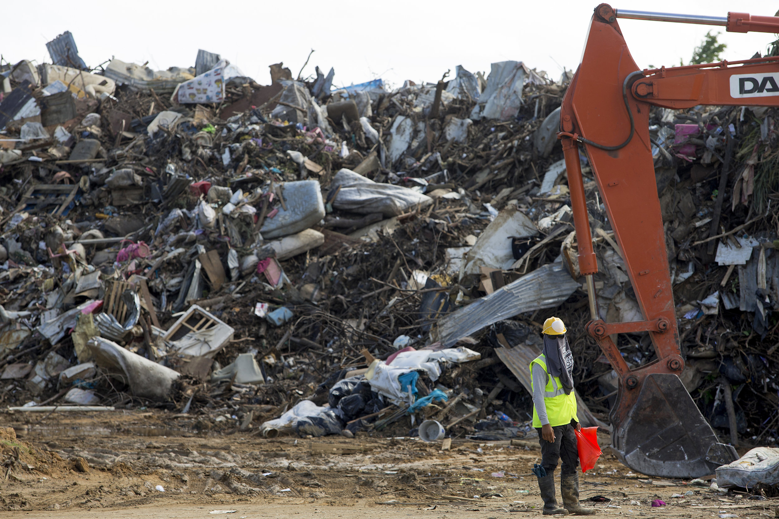
In order to improve transportation, the more than 7 million cubic yards of debris that still scatter the roads and houses must first be cleared. According to CNN, 90% of houses in Puerto Rico were damaged after Hurricane Maria. [1] The storm left behind copious amounts of vegetation and numerous destroyed roofs that had to be removed in order to travel around the state. Many municipal governments turned to using closed schools as sites for depositing vegetative waste and other materials, since they could not dedicate enough funding to waste removal. The U.S. Army Corps of Engineers (USACE) removed 4.15 million cubic yards of waste from 30 municipalities in May of 2018, but the Orlando Sentinel notes that there was still up to 4 million cubic yards of unprocessed debris on the island as of August of 2018. [2][3]
A Data Focused Solution
A potential solution is to focus on optimizing temporary debris management, since poor management typically prolongs the cleanup process. A study done by Zhaojing Wang et al. focuses on collecting data of the state’s waste before and after a disaster to determine where the optimal temporary debris management sites (TDMS) should be placed.[5] TDMS serve as a location to dispose of waste from a natural disaster, where it will be sorted through until transported to plants for final disposal. The study explains specific optimization functions that take into account the volume of debris and its location to suggest the number of TDMS to open, as well as the logistical costs, a timeframe, and a recycling profit. Wang also uses a case study of Hurricane Sandy in Ortley Beach, New Jersey.
This tool could assist Puerto Rico with disaster recovery in the future, given that the management of debris after Maria was inadequate. Specifically, the tool can be used immediately after a hurricane to evaluate the amount of debris, so that a plan for debris management can be formed very quickly. A small team of experts (likely a combination of engineers and mathematicians) would need to evaluate the output of the optimization functions and work with the municipalities in order to implement the suggested TDMSs.
The limitation of this solution is the availability of data and a lack of GIS access right after a natural disaster. A way around this would be to improve the existing communications systems, which is addressed in other aspects of our proposal. As a whole, this specific solution strives to improve the process of debris clearing to provide clear paths for transportation soon after a hurricane strikes.